Taibai Shan Map, Mid-Autumn Festival 1700 太白全圖

Here’s a map of Tai Bai Shan (3750m), the highest mountain in central China’s Qinlin range, which rises about 100km southwest of Xi’an city. The name comes from the mountain’s summit, which shines white with snow for most of the year; “Tai Bai” is the Chinese for Venus, brightest planet in the sky.

Jia Li’s official and personal seals
The map is a rubbing taken from a large stone tablet – about 1.8m high – now in Xi’an’s Beilin Museum (西安碑林博物馆). The tablet was carved in 1700 by Li Shilong (李士龍) and Pu Shi (卜世) from a painting by the provincial governor Jia Li (賈鉝). Jia had gone to the mountain to pray for rain, and afterwards painted the map at the mid-Autumn festival in 1700 as a guide for other visitors.

Original stele in the Beilin Museum, Xi’an
Though Taibai Shan has religious associations, it’s more famous for its scenery than any temples, many of which were fairly rudimentary and have long-since disappeared. Text on the map gives distances between famous sights, and the different vegetation layers – flowering trees lower down giving way to bamboo and pines, then bald rock, and finally the ice-capped peaks – are also pretty accurately depicted.

Sanqing Tarn on left (named after the Taoist trinity), Buddha’s Tarn on the right
The discs just below the highest peaks are Tai Bai’s famous high-altitude glacial ponds (tarns); following the dotted line of the path down from here, you pass down below the “cloud sea” past simple temples, little figures of hikers drawn with hats, bandannas and walking sticks, busy walking, clambering over difficult stone staircases, or sitting down to rest.
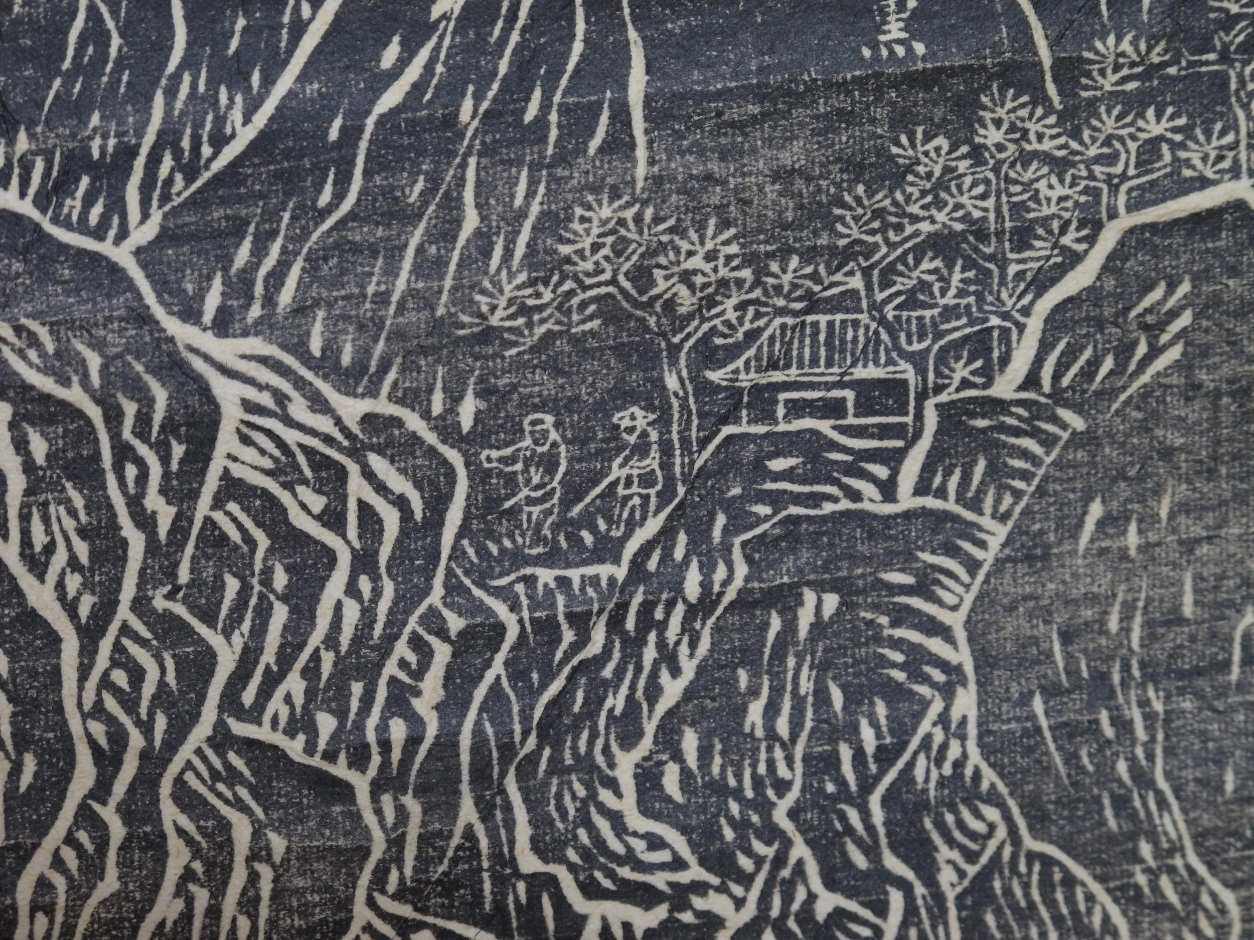
Hikers, temple and pine trees
From a note at the bottom right corner naming the now-ruinous Qingqu Taibai Temple down on the plains below, it’s possible that this tablet was originally housed there. The text reads “From Qingqiu Temple to Sanqing Tarn [just below the summit], a total of 270 li; to Xiangyan Peak 90 li; to Fo Tarn 10 li.” Nowadays a li is standardised at 500m, but in the old days often had less to do with actual distance, and was more about the effort needed to tackle a particular route – so on mountains, the “distance” in li for the same stretch could vary depending if you were going up or down. It’s nowhere near 135km from Qingqiu to the tarns around Tai Bai’s summit – closer to 70km – just that climbing up, it must have felt like it.

“From mountain entrance to Sanguan Pool, 3 li; from Daxue Crag to Wanhu Peak, 30 li“